Product Code Database
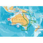
"Navionics Platinum 62P - Australia E & N Brand New Includes One Year Warranty, Product # SD/62PP (SD Card) The Navionics Platinum 62P is the multi-dimensional Platanium marine chart that contains information of Australia E & N which covers Australia East
From Cape York Peninsula to Bass Strait, Tasmania. Including Furneaux Group, Lord Howe Island, Great Barrier Reef, Coringa Islands, Brisbane, Sydney, Deboyne Islands, Milne Bay, Melbourne and Norfolk Islands. The Platinum charts covers the world providing navigators and fisherman with all the necessary data for safer and easier navigation. The Platinum 62P feature the full seamless & IC technology, user selectable safety depth contours, major coastal road networks, high definition fishing details, including dynamic tides and currents, panoramic pictures and more. Platinum 62P Features: Australia E & N Marine Chart, Covers Australia East From Cape York Peninsula To Bass Strait & Tasmania Including Furneaux Group, Full Seamless & IC Technology, Paper Chart-Like Detail, Panoramic Pictures, 3-Dimensional View, User-Selectable Safety Depth Contours, High-Definition Fishing Details, Satellite Photo Overlay, Navaids w/ Xplain&trade, Major Coastal Road Networks, Coastal Points-Of-Interest -Banks, Hotels, & Restaurants, Geo-Referenced Coast Pilot Books, Dynamic Tides & Currents, Enhanged Port Services, NavPlanner / PC Software Compatible, For Humminbird Models: 1100 Series: 1155c, 1157c Combo, 1157c Combo NVB, 1197c SI Combo, 1197c SI Combo NVB, 800 Series: 858c Combo, 898c SI Combo, 900 Series: 955c, 957c Combo, 957c Combo NVB, 958c Combo, 958c Combo NVB, 967c 3D Combo, 997c SI Combo, 997c SI Combo NVB, 998c SI Combo, 998c SI Combo NVB"
|