Product Code Database
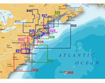
"Navionics Classic - Southeast Maine Brand New Includes One Year Warranty, Product # NC/US827L The Navionics NC/US827L 2-dimensional marine Classic chart contains information of Southeast Maine including Blue Hill Bay and Penobscot Bay to Cape Ann
The Navionics Classic charts provide genuine cartography that's clear and easy to read at all zoom levels, ideal for older generation chartplotters not compatible with Gold Charts. The Classic charts features new large size coverage areas to afford the best available, up-to-date detail to the widest range of Classic compatible models. It also features Depth contours, spot soundings, port plans, port service guides, navigation aids, and more. NC/US827L Features: Southeast Maine Classic Marine Chart, Covers Southeast Maine Including Blue Hill Bay & Penobscot Bay to Cape Ann, Provides Genuine Cartography, Clear & Easy To Read At All Zoom Levels, Depth Contours & Spot Soundings, Large-Size Coverage Areas, Port Plans & Port Service Guides, Navigation Aids, Older Generation Chartplotters Compatible, For Raymarine Models : Raychart : 420 / 425"
|