Product Code Database
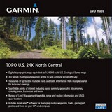
TOPO U.S. 24K North Central DVD brings you the highest level of topographic detail available, with maps comparable to 1:24,000 scale USGS maps.AstroColorado 300Colorado 400cColorado 400iColorado 400tDakota 20Edge 605Edge 705eTrex Legend HCxeTrex Legend CxeTrex Venture CxeTrex Vista HCxeTrex Vista CxGarmin Mobile PCGPSMAP 60CSxGPSMAP 60CxGPSMAP 620GPSMAP 640GPSMAP 76CSxGPSMAP 76Cxnüvi 1200nüvi 1250nüvi 1260Tnüvi 1300nüvi 1350nüvi 1350Tnüvi 1370Tnüvi 1390Tnüvi 1450nüvi 1490Tnüvi 1690nüvi 200nüvi 200Wnüvi 205nüvi 205Wnüvi 250nüvi 250Wnüvi 255Wnüvi 260nüvi 260Wnüvi 265Tnüvi 265WTnüvi 270nüvi 275Tnüvi 350nüvi 360nüvi 370nüvi 465Tnüvi 500nüvi 5000nüvi 550nüvi 600nüvi 610nüvi 650nüvi 660nüvi 670nüvi 680nüvi 750nüvi 755Tnüvi 760nüvi 765Tnüvi 770nüvi 775Tnüvi 780nüvi 785Tnüvi 850nüvi 855nüvi 880nüvi 885TOregon 200Oregon 300Oregon 400cOregon 400iOregon 400tOregon 550Oregon 550tRino 520HCxRino 530HCxStreetPilot 7200StreetPilot 7500StreetPilot c310StreetPilot c320StreetPilot c330StreetPilot c340StreetPilot c510StreetPilot c530StreetPilot c550StreetPilot c580StreetPilot i2StreetPilot i3StreetPilot i5z?mo 450z?mo 550z?mo 660Includes topographic coverage of Idaho, Montana, Wyoming, North Dakota, South Dakota, Minnesota, Nebraska and Iowa.Provides detailed digital topographic maps, comparable to 1:24,000 scale USGS maps.Contains detailed hydrographic features, including coastlines, lake and river shorelines, wetlands and perennial and seasonal streams.Allows you to search by points of interest, including cities, summits, lakes, campsites and more.Provides elevation profile on compatible Garmin devices so you can estimate terrain difficulty.Contains many routable trails, rural roads, city neighborhood roads, major highways and interstates.Displays national, state and local parks, forests, conservation areas and wilderness areas.Includes points of interests such as parks, campgrounds, scenic lookouts and picnic sites.Displays Bureau of Land Management township, r
|


